Some Historical Maps Covering Guysborough County, Nova Scotia
Click on map image to download full scan.
Post 1800

A Map Of Cabotia by John Purdy, 18141 (53 Mb)

Lower Canada by John Arrowsmith 18371 (10Mb)

Province of Nova Scotia, including the island of
Cape Breton by A. & W. Mackinlay, 18651 (21Mb)

Guysborough County 1876 by A.F. Church

Antigonish, Guysborough counties, N.S. by Roe Brothers, 18781 (5Mb)

Map of New Brunswick, Nova Scotia, Prince Edward Island
and Newfoundland, by D. Appleton & Co., 18911 (6 Mb)

Maritime Provinces of Canada Rand McNally, 18971 (8 Mb)

Province of Nova Scotia and Prince Edward Island, Canada by Cummins Map, 19251 (7Mb)

Road Map of Maritime Provinces by Rand McNally, 19401 (25Mb)

Nova Scotia Crown Land Index Sheets by DNR, 1956.
Pre 1800

First known map of Nova Scotia by Diogo Homem in Queen Mary I Atlas, 1558 (1Mb)

A Map of the British Empire in America. (Sheet 7)
by Henry Popple, 17331 (11Mb)

Nova Scotia by Mitchell, 1755 (2Mb)

Map of North America by Domino d'Anville, 1756

Nova Scotia by Brown and Gibson, 17581 (2 Mb)

Map of Canso Harbour by Montagu Wilmot, 1764

Map of Nova Scotia, or Acadia; with the islands of Cape Breton and St. John's by Captn. Montresor, engir, 1768

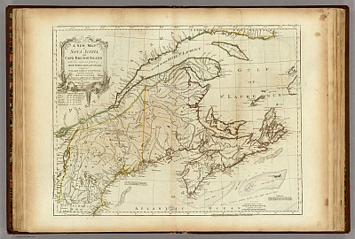
A New Map of Nova Scotia, and Cape Breton Island
by Thomas Jefferys, 17761 (11Mb)

A General Map of the Northern British Colonies
in America by Robert Sayer and John Bennett, 17761 (10Mb)

New Map of Nova Scotia, New Brunswick and
Cape Breton by Jedidiah Morse, 17941 (3 Mb)
 Home
Home Links
Links Facebook
 Obituaries
 References
 Genealogies
 Glossary
 Time Line
 Censuses
 Database Search
 Picture Gallery
 Places
 Cemetery Listings
 Historical Maps
 Help
Help Courses
 Getting Started
 Contact